|
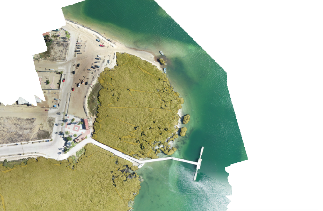
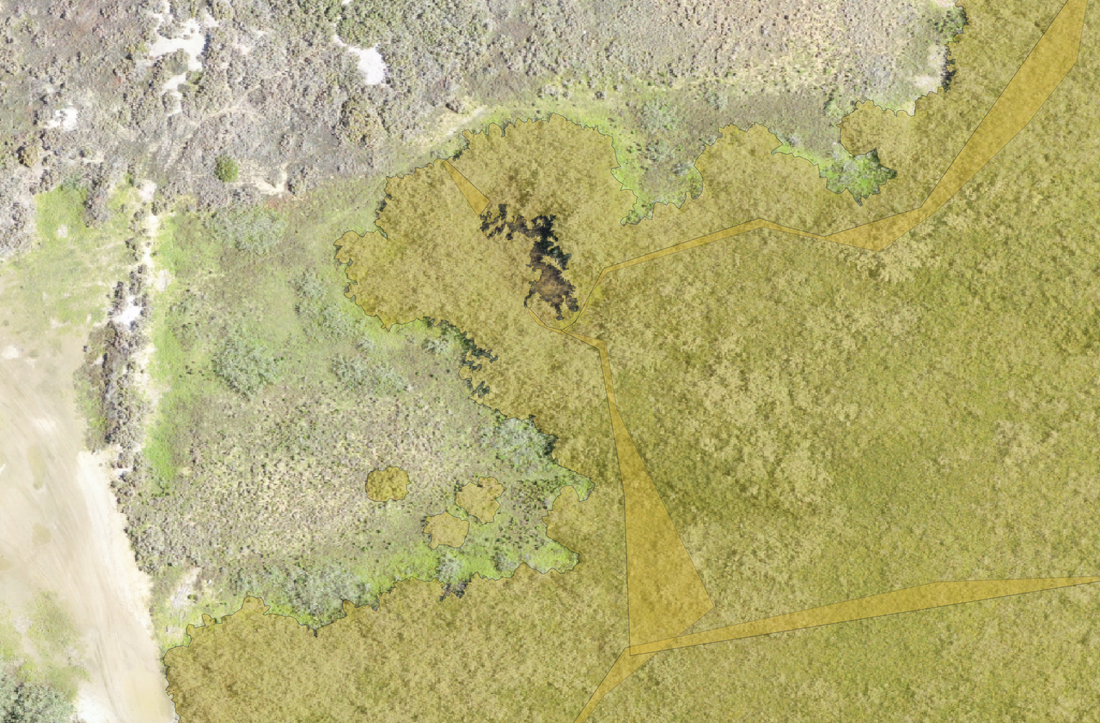
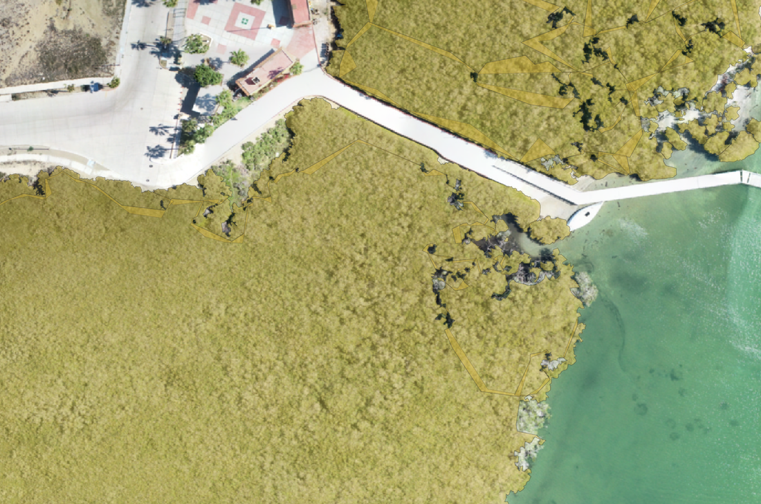
Here are some photos of my final product: 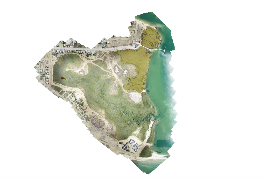
During my time at internship I got the opportunity to play a part in the creation of an algorithm which detects mangrove habitats. For those of you that don't know, a mangrove is a plant native to Baja California which plays a big role in many of the ecosystems which reside there. My job was to label mangrove habitats through a program called QGIS, which is a geographical information system. I had one third of the overall map, because I was splitting this work with my other fellow interns. The data my peers and I created in this software will be fed into an AI which will then be able to detect mangrove autonomously in the future.
The process of labeling mangrove consisted of a lot of attention to detail, patience, and communication. Without any of those things, this task would have been much more difficult and harder to accomplish. With the help of my peers and my mentors, I was able to successfully complete my section of the orthomosaic map. I am grateful to have been given this opportunity to experience what other career paths may be like. To see my POL slides, please click here.
0 Comments
Leave a Reply. |
Author12th grade student at High Tech High North County interning at Scripps Institute of Oceanography, a lab at UCSD that specializes in mangrove habitats 
ArchivesCategories |
 RSS Feed
